How Drones Are Helping India Fight Forest Fires
Quick Summary
- India loses approximately 3.73 million hectares of forest to fires every year, with economic damage estimated at Rs. 1.74 lakh crore annually. Satellites detect most of these fires too late to prevent major damage.
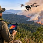
- Drones equipped with thermal cameras and onboard AI can detect a fire through smoke and dense canopy before visible flames appear, sending an alert to forest officials in seconds rather than hours.
- States like Odisha, Uttarakhand, Tamil Nadu, and Maharashtra are already running permanent drone-based fire monitoring programmes, not pilots or experiments.
- After the fire is out, heavy-lift drones are being used to drop seed balls over burned terrain that human crews cannot safely reach, turning a destructive event into a reforestation opportunity.
Every year, when the dry season arrives, India’s forests start burning. In 2023-24, satellite systems detected over 2,03,544 active fire hotspots across the country. Andhra Pradesh lost 5,287 square kilometres of forest area to fires in that single season. Maharashtra lost 4,095 square kilometres. Uttarakhand, in the Himalayan belt, saw a 293 percent increase in fire incidents compared to the previous year.
The numbers are staggering. But the real problem is not the size of the fires once they are burning. It is how long it takes to detect them.
The satellite systems India uses, MODIS and VIIRS, are powerful tools. But MODIS has a resolution of 1 km by 1 km. A fire must reach a substantial size before an orbital sensor can register it. Add in cloud cover, forest canopy, and the delay between satellite passes, and you have a detection gap that can last hours. In that time, a small ground fire becomes a crown fire.
Drones are changing this equation.
How Drones Detect Fires Before Satellites Can
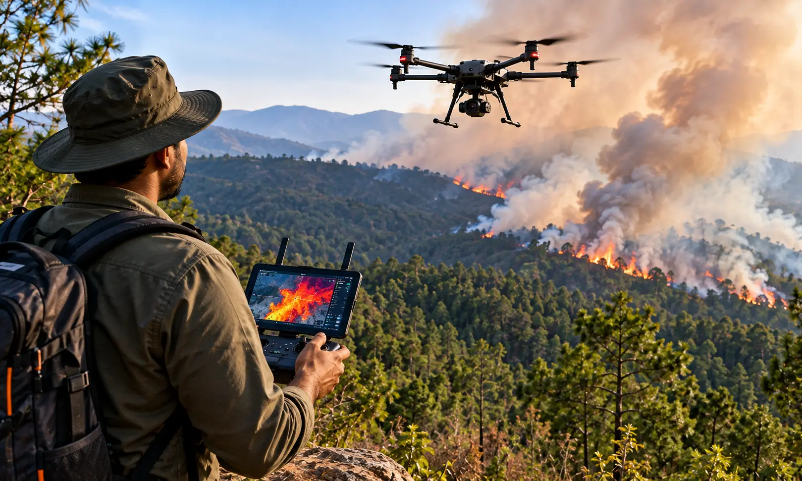
A thermal camera mounted on a drone does not need visible flames to detect a fire. It reads heat. Even a smouldering patch of ground beneath a dense canopy, invisible to any optical sensor, emits a distinct infrared signature that a drone-mounted thermal sensor can identify from hundreds of metres in the air.
Modern forest patrol drones combine two sensor types: a regular RGB camera for visual confirmation and a thermal sensor for heat detection. Where this becomes particularly powerful is when onboard artificial intelligence processes both feeds simultaneously. Systems running models like YOLOv8 analyse the shape and behaviour of smoke plumes visually while simultaneously tracking temperature anomalies thermally. Together, these systems achieve fire detection accuracy exceeding 95 percent.
When a fire is confirmed, the drone does not send a raw video feed, which would require significant bandwidth in remote forest areas. It sends a compact alert package: GPS coordinates, a fire probability score, and a single composite image. This reaches the forest control room in seconds.
The difference between detecting a fire at 0.1 hectares and 10 hectares can mean the difference between containment and catastrophe.
The Training: From Village to Certified Pilot in 15 Days
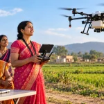
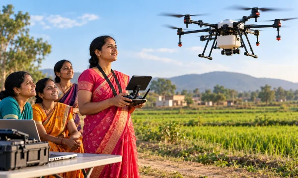
The scheme does not just hand over a drone. It funds a full 15-day training programme that turns an SHG member into a legally certified commercial drone pilot.
The first five days are conducted at a DGCA-approved RPTO. The trainee covers aviation theory, airspace regulations, flight simulation, and safety protocols. At the end of this module, she receives her Remote Pilot Certificate, making her a licensed commercial drone operator.
The next ten days shift to agricultural applications: chemical mixing, safe payload handling, spray calibration, and managing different crop canopies.
A second SHG member simultaneously completes a five-day Drone Assistant course covering battery management, equipment transport, field repairs, and chemical preparation. This two-person team structure is what makes daily operations efficient. While the pilot flies, the assistant swaps batteries, refills payload tanks, and manages ground logistics. Together, they can cover 20 to 25 acres per day without significant downtime.
Who Is Already Doing This in India
This is not experimental technology. Several state forest departments are running permanent programmes.
Odisha, Similipal Tiger Reserve: Following repeated severe fire seasons, the Odisha Forest Department inducted a fleet of 50 mini-drones across the reserve’s north and south divisions. The drones track real-time fire progression in terrain that ground patrols cannot reach and simultaneously monitor illegal movement in core forest areas. The aerial intelligence directs targeted ground interventions with a speed and precision that was not possible before.
Uttarakhand: Dealing with the extreme topography of the Garhwal and Kumaon Himalayas, where fire can spread across sheer vertical terrain that humans cannot access, Uttarakhand uses drones across the full response cycle: detection, monitoring, and post-fire reforestation. After the 2024 fires in the Nainital Forest Division, heavy-lift drones broadcast over 1,25,000 seed balls across 250 hectares of inaccessible slopes. The aerial seeding initiated soil stabilisation before the monsoon arrived, a task that would have taken human crews months.
Maharashtra, Pench Tiger Reserve: The forest department launched an AI-driven system called Pantera that combines continuous aerial and ground data feeds to provide hyper-local fire alerts, moving beyond dependence on delayed satellite information.
Tamil Nadu: The state is piloting a combined approach using both unmanned aerial vehicles and unmanned ground vehicles, testing autonomous fire containment and remote water-cannon deployment in the ecologically sensitive Western Ghats.
Andhra Pradesh: Beyond fire fighting, the state has used drones to distribute over 2 crore seed balls across 20,929 hectares of degraded forest in post-fire restoration programmes.
What Women Are Actually Earning
The scheme sets a minimum annual income target of Rs. 1 lakh per SHG. The reality, for many active operators, is considerably better.
At the standard rate of Rs. 300 to Rs. 400 per acre, covering 20 to 25 acres per day generates Rs. 8,000 to Rs. 12,000 in gross daily revenue during peak season. Across a peak agricultural window, this translates to Rs. 60,000 to Rs. 80,000 per month for active operators.
Real case data from across India confirms this:
Shabina, Ayodhya, Uttar Pradesh: Charging Rs. 400 per acre and combining drone services with her existing polyhouse farming operation, Shabina grew her gross annual income from Rs. 2.5 lakhs to Rs. 8 to 10 lakhs. Net income reached Rs. 5.5 to 6.5 lakhs, a fourfold increase.
Kiran Ahirwar, Guna, Madhya Pradesh: Even during off-peak periods, Kiran earns Rs. 12,000 to Rs. 15,000 monthly by combining drone crop monitoring, soil analysis, and vermicomposting.
These are not exceptional cases. They reflect what the model delivers when run with consistent effort.
What the Drones Are Actually Doing
The role varies depending on the stage of the fire.
| Phase | Drone Role | Platform Type |
|---|---|---|
| Pre-fire patrol | Long-range thermal scanning, early anomaly detection | Hybrid VTOL (120-150 min flight time, 15-20 km range) |
| Active fire | Live thermal mapping, fire spread tracking, smoke assessment | Multirotor with thermal payload |
| Suppression | Water or retardant payload drops, firefighting ball delivery | Heavy-lift multirotor (30-45 min) |
| Post-fire | Damage mapping, ecological assessment, seed ball dispersal | Various |
For wide-area patrol, hybrid VTOL drones like the ideaForge SWITCH cover 15 to 20 kilometres and stay airborne for up to 150 minutes. For active suppression, heavy-lift multirotors carry payload systems capable of delivering water, dry chemical powder, or specialist firefighting balls that detonate on contact with flames.
For fires near structures or in industrial zones, drones have proven their value in unexpected situations. During a chemical factory fire in Gujarat in 2023, drones assessed toxic smoke plumes and identified safe entry points for ground crews before anyone physically approached the site. During a high-rise fire in Mumbai in 2021, drones provided live thermal and visual assessment of upper floors beyond the reach of ladder trucks.
The Limits of What Drones Can Do Right Now
Being clear about limitations builds credibility, and the limitations here are real.
Heat turbulence: Large forest fires generate intense updrafts that destabilise lightweight drones. Flying directly over a crown fire is dangerous, and not all platforms can handle the aerodynamic stress.
Battery performance in extreme heat: Lithium-polymer batteries degrade quickly when ambient temperatures are high. A drone rated for 40 minutes of flight near a fire front may deliver only 20 minutes of actual use.
Mountain terrain: In states like Uttarakhand and Himachal Pradesh, steep valleys and ridges block the radio link between the pilot and the drone, limiting operational range. The 2023-24 season saw Himachal Pradesh report a 1,339 percent increase in fire incidents, precisely the kind of terrain where drone limitations bite hardest.
Volume of suppression: Even the best heavy-lift drone carries a fraction of the water a helicopter Bambi Bucket deploys. Drones handle initial attack and spot fires. They do not replace aircraft for large, fast-moving fronts.
What Is Coming Between 2026 and 2030
The next evolution is autonomous drone swarms. Using multi-agent coordination algorithms, fleets of 20 to 50 drones will patrol vast forest tracts without overlapping, splitting the area between them intelligently. When a fire is detected, suppression drones are pre-positioned toward the most vulnerable sectors based on real-time wind and topography data, arriving before the fire does.
BVLOS corridors, expected to be formally established by the end of 2026, will allow drone command centres to operate hundreds of kilometres from the incident, launching drones from remote solar-powered docking stations the moment an FSI satellite alert fires.
Reforestation by drone is also scaling rapidly. India has committed to restoring 26 million hectares of degraded land by 2030, and aerial seed dispersal is the only viable method for the steepest, most fire-damaged terrain.
FAQs
Thermal sensors detect the heat signature of the fire itself, not the visible light. They read temperature gradients through smoke particulates and forest canopy, identifying smouldering ground fires before visible flames emerge.
For small, spot fires, yes. Heavy-lift drones can carry water payloads and specialist firefighting balls that detonate on contact with flames. For large crown fires, drones manage initial containment and provide intelligence. They work alongside, not instead of, manned aircraft.
Odisha, Uttarakhand, Tamil Nadu, Maharashtra, and Andhra Pradesh all have active, permanent drone deployment programmes for forest fire management. Several other states are in pilot stages.
Yes. Forest department drone operators and contracted pilots must hold a DGCA Remote Pilot Certificate. Emergency BVLOS exemptions are available for disaster operations, but the baseline certification requirement remains.
Yes. Post-fire, drones conduct ecological damage assessment using multispectral and LiDAR sensors. Then heavy-lift drones distribute native seed balls across fire-damaged slopes too steep and unstable for human planters, accelerating reforestation before the next monsoon.
Summary
India’s forest fire problem is large, seasonal, and worsening in the Himalayan belt. Satellites help but they detect fires too late. Ground crews cannot reach enough of the terrain fast enough. Drones are filling both gaps simultaneously, detecting fires earlier, tracking them more accurately, guiding ground teams more precisely, and restoring forests faster after the damage is done.
This is a sector where certified drone pilots with thermal imaging skills are genuinely in demand, working with state forest departments and private environmental contractors across the country. Our drone training programmes at CIGPL build the practical foundation you need to work in this and other high-impact sectors.