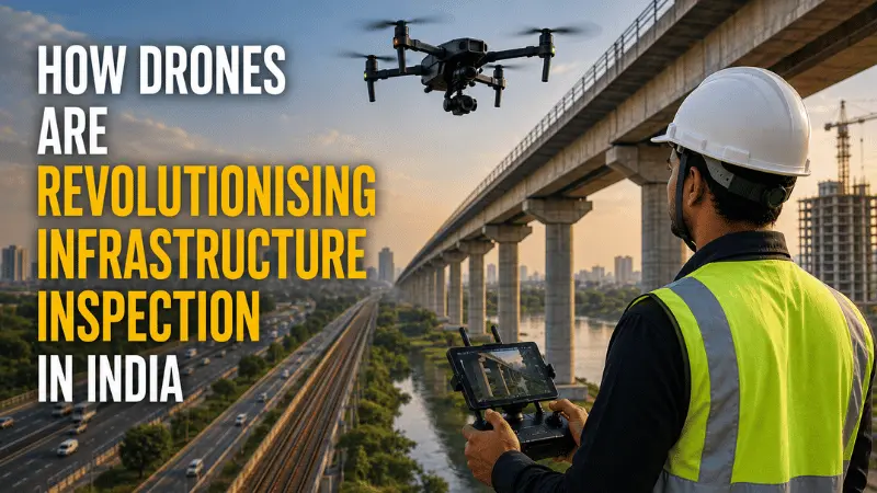
How Drones Are Revolutionising Infrastructure Inspection in India
Quick Summary
- Drone infrastructure inspection costs 60 to 80 percent less than traditional manual inspection and completes work up to ten times faster, while capturing objective data that human inspection cannot match.
- Government mandates are making drone inspection compulsory rather than optional: NHAI requires monthly drone surveys for all national highway projects, Indian Railways mandates drone inspection of major bridges, and solar operators must follow international standards for thermal drone surveys.
- Senior drone inspection specialists in India earn Rs. 85,000 to Rs. 1,15,000 per month, with the highest salaries going to pilots who combine flying with thermal imaging analysis, LiDAR processing, or GIS data skills.
- The global infrastructure drone inspection market is projected to reach USD 43.8 billion by 2034. India’s own commercial drone market will double from USD 1.2 billion to USD 2.4 billion by 2034.
In September 2023, severe flooding near Gwalior cut off ground crews from critical power grid infrastructure. Roads were submerged. Manual inspection was impossible. The Madhya Pradesh Power Transmission Company had drone patrol teams, and they deployed them immediately. The drones accessed the inundated sectors, inspected the high-voltage lines, and transmitted data back in real time. The grid was restored faster than it would have been through any traditional approach.
That incident is not unusual anymore. It is an example of why drone-based infrastructure inspection has shifted from an interesting technology experiment to a non-negotiable operational tool across India’s energy, transport, and industrial sectors.
India has over 4,85,000 circuit kilometres of power transmission lines, more than 34,000 kilometres of oil and gas pipelines, 1,50,000 railway bridges, and a national highway network expanding rapidly under Bharatmala. Inspecting all of this manually is slow, expensive, and dangerous. Drones change all three of those things at once.
This article explains how drone infrastructure inspection works, where it is being used across India, what the regulations require, and what the career opportunities look like for certified pilots in this sector.
How Drone Infrastructure Inspection Actually Works
The process starts well before the drone leaves the ground. Operators use GIS data and engineering drawings to plan the flight path, setting the altitude, speed, and camera intervals needed to capture complete coverage. The overlap between consecutive images is typically set at 60 to 70 percent, ensuring every feature is captured from multiple angles for accurate 3D modelling.
During the flight, the drone captures data using one or more sensor types depending on what is being inspected. The GPS positioning accuracy is enhanced through Real-Time Kinematic (RTK) modules that bring positional error down to centimetre level, which matters when you are measuring structural clearances or documenting exact defect locations.
After the flight, the raw data goes through processing software. Photogrammetry algorithms stitch overlapping images into accurate 3D models, orthomosaics, and thermal maps. AI-based computer vision then automatically identifies and classifies defects, whether that is a cracked insulator on a power tower, an overheating solar panel, or rust on a bridge girder. These findings are tagged with precise GPS coordinates and fed directly into asset management systems, giving engineers a complete, searchable record of every defect found.
What Sensors Are Used and Why
Different inspection jobs need different sensors. Here is how each one works in plain terms.
RGB cameras (high-resolution visual): The standard starting point for most inspections. Modern drone cameras at 48 megapixels or higher capture surface defects: cracks, rust, missing bolts, physical damage. Thousands of overlapping images are processed into 3D models that engineers can zoom into remotely.
Thermal cameras (infrared): These detect heat. They do not see what the eye sees but what the temperature shows. Overheating solar panels, failing electrical components, and insulation degradation all produce thermal signatures that a visible camera completely misses. International inspection standards require thermal sensors to detect temperature differences as small as 0.1 degrees Celsius to be considered valid for fault reporting.
LiDAR (laser scanning): LiDAR fires laser pulses and measures how long they take to return. It produces dense 3D point clouds of the environment. Crucially, LiDAR pulses can pass through gaps in forest canopy to map the ground beneath, making it essential for powerline corridor surveys where vegetation management is critical. LiDAR can measure the exact clearance between energised powerlines and growing trees with centimetre accuracy, predicting fault risks before they become outages.
Optical Gas Imaging (OGI): Specialised sensors tuned to detect specific infrared wavelengths emitted by methane and hydrocarbon gases. Used along oil and gas pipelines to spot leaks that are invisible and odourless at inspection distances.
Electroluminescence (EL) imaging: Emerging in solar inspection, this detects deep internal cracks in solar panels that even thermal cameras miss. It works by capturing the faint near-infrared light solar cells emit when a current is applied.
Where Drones Are Being Used for Infrastructure Inspection in India
Power Transmission and Distribution
India’s power grid crosses forests, river valleys, mountain ranges, and inaccessible hill sectors. Manually patrolling these routes is both physically impossible in many areas and financially prohibitive everywhere.
Power Grid Corporation of India (POWERGRID) runs an in-house drone fleet for routine inspection of extra-high-voltage lines from 115 kV to 765 kV. At the state level, MPPTCL now routinely monitors over 10,000 circuit kilometres and 23,000 EHV towers across Indore, Bhopal, and Gwalior using drone patrol teams. Drones identify insulator failures, corrosion, conductor damage, and vegetation encroachment before these become outages.
The biggest technical challenge here is electromagnetic interference. Power lines carrying 500 kV or more generate magnetic fields that can disrupt a drone’s navigation sensors and cause erratic flight. There is also a real risk of electrical arcing between the energised cable and the drone’s carbon-fibre body. Drones used near EHV lines need specialised shielding and navigation algorithms to operate safely.
Solar Farms
India has rapidly expanding utility-scale solar capacity across Rajasthan, Gujarat, Karnataka, and Andhra Pradesh. A single solar park can exceed 500 megawatts in capacity, covering enormous ground. Manually inspecting every panel in a large farm takes days and still only catches visible surface damage.
A drone thermal inspection covers a 1 MW solar plant in 15 minutes at a cost of Rs. 3,000 to Rs. 8,000. The equivalent manual inspection takes 4 to 6 hours and costs Rs. 15,000 to Rs. 25,000, and it misses the electrical faults that thermal cameras catch. The drone identifies overheating cells, bypass diode failures, and degradation patterns caused by dust in Rajasthan or humidity in coastal regions.
Solar thermal inspections must comply with the international standard IEC 62446-3, which is enforced by lenders and insurers in India. This standard requires minimum solar irradiance of 600 W/m² and wind speeds below 28 km/h for data to be considered valid. Inspections on cloudy days or windy afternoons simply do not count.
Oil and Gas Pipelines
India has over 34,000 kilometres of oil and gas pipelines managed by organisations including GAIL and IndianOil. GAIL uses drones to patrol its 15,000 km network specifically targeting encroachment by third-party construction and physical safety hazards. IndianOil combines drone surveillance with an optical fibre Pipeline Intrusion Detection and Warning System for continuous monitoring.
In August 2021, IndianOil used this integrated system to spot and prevent a theft attempt on a petroleum pipeline at Sonipat. The drone tracking and intrusion detection system identified the threat in time for intervention.
National Highways
NHAI now legally mandates monthly drone video recording for all national highway projects. This applies from pre-construction through the 15-year operation and maintenance period. Contractors who fail to comply face a penalty of Rs. 5 lakhs. The footage is permanently archived on NHAI’s cloud platform, the “Data Lake,” and is used as evidence in arbitral disputes and contract verification.
The system was first piloted during construction of the Delhi-Mumbai expressway, where it successfully resolved contractor billing disputes quickly and led to the nationwide mandate.
Indian Railways
Indian Railways manages over 1,50,000 bridges, thousands of which are classified as critical structures. RDSO guidelines (BS-129) mandate drone inspection of mega bridges, with data integrated into the Railway Board’s centralised Bridge Management System for predictive maintenance.
Drones access the undersides of bridges and difficult elevations without scaffolding, capturing imagery and point clouds that feed into 4D Bridge Information Modelling systems. This allows engineers to track structural degradation over time and schedule maintenance before failures occur, without imposing lengthy track blocks that disrupt train schedules.
Wind Turbines and Telecom Towers
Wind turbines require close-proximity inspection of blades, nacelles, and monopile foundations. Manual rope-access descent from turbine tops is one of the most dangerous jobs in the energy sector. Drones perform this inspection autonomously, detecting lightning strike damage, leading-edge erosion, and stress cracks without putting any person at height.
Reliance Jio, which acquired drone manufacturer Asteria Aerospace, conducts drone-based tower surveillance ahead of its 5G rollout. Indus Towers uses aerial inspection services for lifecycle asset management across its infrastructure portfolio.
How Drone Inspection Compares to Manual Inspection
| Metric | Manual Inspection | Drone Inspection |
|---|---|---|
| Speed (1 MW solar plant) | 4 to 6 hours | 15 minutes |
| Speed (100-acre highway site) | 2 to 3 days | Under 2 hours |
| Cost (solar, per MW) | Rs. 15,000 to 25,000 | Rs. 3,000 to 8,000 |
| Asset coverage | 10 to 30% sampling | 100% coverage |
| Defect detection rate | Visual surface only | Over 95% including sub-surface thermal faults |
| Safety risk | High (scaffolding, rope access, EHV exposure) | Minimal (remote operation) |
| Asset downtime required | Often yes (shutdowns, track blocks) | Zero downtime |
The Regulations That Are Making Drone Inspection Compulsory
NHAI: Monthly drone surveys mandatory for all highway projects. Rs. 5 lakh penalty for non-compliance. Data archived permanently.
Indian Railways (RDSO): Drone inspection of critical bridges mandated, data integrated into centralised Bridge Management System.
Oil and gas (OISD and PNGRB): Drone inspections must comply with OISD integrity codes for pipeline right-of-way management and encroachment auditing.
Solar (IEC 62446-3): Thermal drone inspections must meet specific irradiance, wind speed, and temperature differential standards. Defects are classified by severity: CoA2 (temperature difference over 10°C) and CoA3 (safety-critical, over 25°C).
DGCA (all operations): Every commercial inspection drone must have a Type Certificate and UIN. Every pilot must hold a valid Remote Pilot Certificate from a DGCA-approved RPTO. The Draft Civil Drone Bill 2025 proposes dedicated BVLOS corridors specifically for pipeline and powerline inspections.
Career and Salary Outlook for Infrastructure Inspection Pilots
This is one of the highest-paying sectors in the Indian drone industry, and the gap between a basic pilot and a specialist is significant.
| Experience Level | Monthly Salary | Annual Package | Profile |
|---|---|---|---|
| Entry-level (0 to 2 years) | Rs. 25,000 to 45,000 | Rs. 3.0 to 5.5 LPA | Holds RPC, performs basic field operations under supervision |
| Mid-level specialist (2 to 7 years) | Rs. 40,000 to 80,000 | Rs. 8.0 to 18.0 LPA | Combines flying with data analytics, photogrammetry, GIS processing |
| Senior specialist (5 years and above) | Rs. 85,000 to 1,15,000+ | Rs. 22.0 to 60.0 LPA | Manages BVLOS operations, industrial inspections, LiDAR processing |
What pushes salaries higher: Pilots who add thermal imaging analysis, LiDAR point-cloud processing, GIS software proficiency, or BVLOS operational experience earn 28 to 35 percent more than pilots with equivalent flight experience but no data skills. The ability to not just capture data but interpret it and deliver actionable reports is where the real premium sits.
Freelance operators and DaaS businesses focused on infrastructure inspection regularly generate net incomes of Rs. 15 to 40 lakhs annually after initial setup, because the niche requires specialised equipment and skills that very few operators can offer.
The training investment pays back quickly. The average payback period for drone certification costs in India is around 11 months.
What Skills and Certifications Do Employers Look For?
Beyond the DGCA Remote Pilot Certificate, employers in the infrastructure inspection sector value:
Thermal imaging competence: Understanding how to interpret radiometric data, calibrate thermal cameras, and apply IEC standards for solar inspection.
LiDAR processing: Ability to classify point clouds, measure clearances, and extract meaningful engineering data from dense 3D datasets.
GIS and photogrammetry software: Pix4D, Agisoft Metashape, ArcGIS, or QGIS for converting raw flight data into usable engineering deliverables.
Manual flight precision: Infrastructure inspection often requires flying within metres of active powerlines, turbine blades, or bridge structures. Confident manual flying without GPS assistance is a genuine differentiator.
Understanding of sector standards: Knowledge of IEC 62446-3 for solar, RDSO BS-129 for railways, or OISD codes for pipelines demonstrates that you understand the compliance context around your work.
If you are looking to build toward infrastructure inspection roles, the Surveillance and Mapping Drone Course at CIGPL builds the data acquisition and processing skills that this sector specifically demands, on top of the Remote Pilot Certificate that is the legal foundation for all commercial operations.
What Is Coming Between 2026 and 2030
Drone-in-a-box systems: Self-contained docking stations installed permanently at industrial sites will allow drones to launch, inspect, upload data via 5G, and recharge autonomously on a scheduled basis. No human pilot deployment needed for routine monitoring.
Edge AI for real-time analysis: Instead of sending data to the cloud after a flight, drones will process images onboard using advanced computing chips. If a defect is detected mid-flight, the drone will autonomously redirect for a closer look before returning to base.
BVLOS corridors: As DGCA regulations mature, dedicated beyond-visual-line-of-sight corridors will allow drones to inspect hundreds of kilometres of pipelines or powerlines in a single automated flight, removing the current constraint of keeping the drone within visual range.
The global infrastructure drone inspection market is projected to reach USD 43.8 billion by 2034. India’s commercial drone market will grow from USD 1.2 billion to USD 2.4 billion over the same period. The demand for qualified inspection specialists will grow proportionally.
FAQs
Drone inspections cost 60 to 80 percent less than manual inspection in most infrastructure sectors. For solar farms, the cost drops from Rs. 15,000 to 25,000 per MW manually to Rs. 3,000 to 8,000 per MW by drone.
Yes. NHAI mandates monthly drone surveys for all national highway projects. RDSO mandates drone inspection of major railway bridges. These are legal compliance requirements, not optional upgrades.
Yes, but it requires specialised equipment. Strong electromagnetic fields from EHV lines can disrupt standard drone navigation sensors. Drones used for powerline inspection need shielded electronics, advanced navigation algorithms, and in some cases Faraday cage-like housing to prevent arcing.
No. The international standard IEC 62446-3 requires a minimum solar irradiance of 600 W/m² for thermal data to be valid. Cloudy conditions reduce irradiance below this threshold, making it impossible to detect electrical faults through temperature differentials.
A DGCA Remote Pilot Certificate is the legal baseline. Employers also expect proficiency in thermal imaging, photogrammetry or GIS software, and ideally knowledge of sector-specific standards like IEC 62446-3 for solar or RDSO BS-129 for railways.
No. Most large infrastructure companies and DaaS firms provide the equipment. You are hired for your certification, technical skills, and ability to produce compliant deliverables.
Start with the RPC, then add data processing skills through a mapping course. Hands-on experience with thermal cameras and LiDAR, even in a junior assistant role, builds the portfolio that senior inspection roles require.
Summary
Drone infrastructure inspection in India has moved from a pilot programme to a mandated requirement across highways, power grids, railways, pipelines, and solar farms. The economics are clear: faster, cheaper, safer, and more accurate than manual methods. The regulations are making adoption compulsory rather than optional.
For drone pilots, this is one of the highest-paying and most technically interesting sectors in the industry. The pilots who earn the most are not just flying. They understand thermal imaging, LiDAR data, and GIS analysis well enough to produce the kind of reports that engineers and asset managers can actually act on.
Our drone training programmes at CIGPL are designed to build exactly this kind of competence. Start with the Remote Pilot Certificate and build toward specialisation with the Surveillance and Mapping Drone Course, which covers the data skills that infrastructure inspection employers specifically need.
India’s infrastructure is being built and maintained from the air. The question is who is doing the flying and the analysis.